New Synthetic Vision System for the Digital Cockpit
A pilot's greatest asset is situational awareness. In modern aviation, technology plays a crucial role in providing a clear picture of the surrounding environment, especially when visibility is low.
8 Oct 2025
We’ve already implemented the pass-through and visual camera layers. Now we're thrilled to show you our very own Synthetic Vision System.
A 3D Model on Your Screen
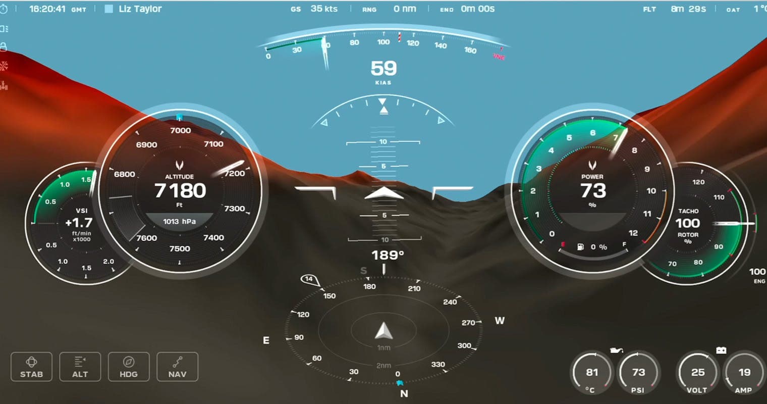
The Synthetic Vision System replaces the standard artificial horizon with a dynamic, 3D model of the surrounding terrain. This system is designed to dramatically improve a pilot's awareness in challenging conditions, such as poor visibility or flight through extreme terrain.
How it works:
- 3D Terrain : The system processes vast amounts of topographical data to generate a real-time, 3D view of the landscape right on your Primary Flight Display (PFD).
- Intuitive Colour Coding: To make the display instantly readable, the terrain is colour-coded based on its altitude relative to your aircraft. Terrain above you is highlighted in amber or red, while terrain below you is shown in grey. We're still fine-tuning these colour schemes to find the perfect balance of clarity and information.
- Situational Awareness Aid: Its primary goal is to keep you aware of your surroundings at all times. This is a powerful aid for visual flight rules (VFR) flying, not a certified replacement for instrument flight rules (IFR) navigation.
The Data Behind the Display
A system like this is only as good as the data that powers it. We're currently using high-quality public data sets, including the European Space Agency's Copernicus data set and the US Shuttle Radar Topography Mission.
However, our ultimate goal is to integrate a fully certified, global data set. We plan to migrate to a provider like Jeppesen, which will give us a continuous, verified data set without any gaps or voids. This ensures the system is reliable anywhere in the world.
Adding Obstacles and More
The terrain is just the beginning. The next major development phase for the SVS is layering in crucial obstacle data: towers, buildings, power lines & wires.
Unlike terrain, which is relatively static, obstacles vary wildly in shape and size. We are carefully designing a data pipeline to not only render these objects accurately but also to manage data obsolescence, ensuring that what you see in the cockpit reflects the real world.
Every detail, from a new radio tower to a decommissioned building, must be handled with precision.
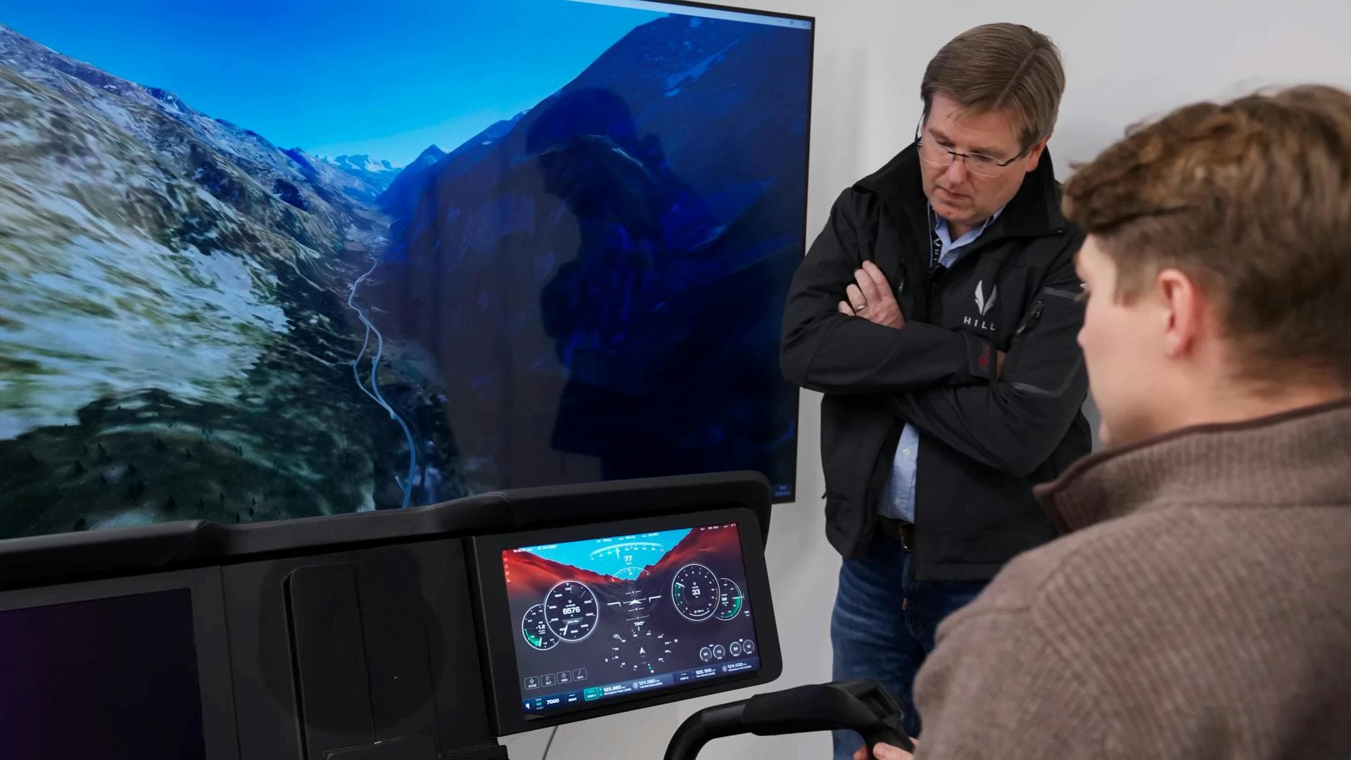
Performance on Target Hardware
We’ve successfully ported the system to our target hardware, and the results are very positive thus far. There is still work to be done, namely implementing a level of detail (LOD) approach, rendering nearby terrain at high resolution while gradually reducing the detail for features on the horizon.
Also, we have plenty of processing headroom left, giving us ample capacity for future features and growth.


JOIN OUR GROUP PRESENTATION
Are you interested in the HX50? Book your spot in our group presentation and learn why the HX50 will be better than your current helicopter.
What's in the presentation
Who
Mischa Gelb (aka Pilot Yellow) and Ruben Dias
What
Exclusive full details about the HX50 not yet available to the public
How
30-minute presentation + Q&A
Be part of the journey
Get all the relevant news and updates about the HX50 delivered to your inbox.
HX50
Exterior Concept
Interior Concept
GT50 Turbine Engine
General Aviation 2.0
Hill Digital Cockpit
News & Stories
Technical Details
Range Simulator
Journey to HX50
ADDRESS
Hill Helicopters
Unit 3, Shackleton Way
Stafford, ST16 1GY
United Kingdom
Contact
General Enquiries:
+44 (0) 1384 590700
Accounts:
+44 (0) 1384 590700
Sales:
+44 (0) 1889 228040
hello@hillhelicopters.com
ADDRESS
Hill Helicopters
Unit 3, Shackleton Way
Stafford, ST16 1GY
United Kingdom
© 2026 HILL HELICOPTERS